Volcano Hiking in Rwanda -Ultimate Guide 2026/2027
Volcano hiking in Rwanda offers an unforgettable high-altitude adventure across the majestic Virunga Mountains.
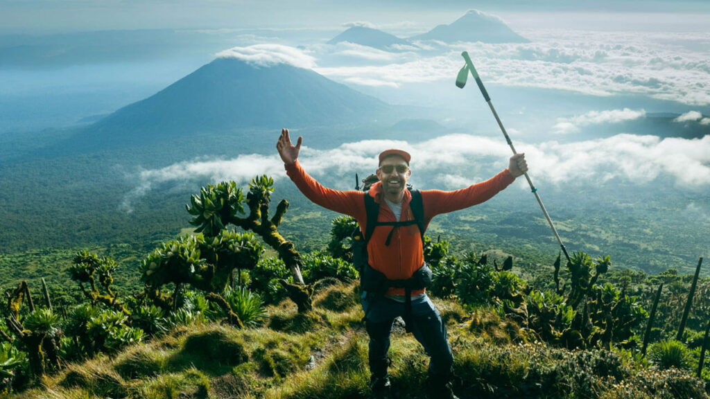
Key peaks include Mount Bisoke with its stunning crater lake, the towering Mount Karisimbi, and the rugged Mount Sabyinyo.
Climbers experience rich biodiversity, dramatic volcanic geology, and sweeping regional panoramas.
Introduction to Rwanda’s Volcanic Wonderland
Rwanda is rightfully celebrated worldwide as the “Land of a Thousand Hills.”
Beyond its terraced hillsides, rolling tea plantations, and lush valleys, the country’s northwest border rises into a dramatic spine of prehistoric giants: the Virunga Mountains.
This chain of majestic, chain of five dormant stratovolcanoes dominates the landscape of Volcanoes National Park (Parc National des Volcans).
While the country is globally famous for mountain gorilla trekking, volcano hiking in Rwanda offers an entirely different, deeply rewarding raw adventure.
It is a journey that takes you through ancient bamboo forests, rare Afro-alpine moorlands, and eerie volcanic craters.
Whether you are looking for a challenging single-day mountaineering exploit or a gentle scenic trek, the Virunga provide an unforgettable African trekking experience.
This comprehensive guide covers everything you need to know to plan, prepare for, and conquer the magnificent volcanic peaks of Rwanda.
The Peaks of Volcanoes National Park
Volcanoes National Park protects the Rwandan sector of the Virunga Massif.
Within its boundaries lie five distinct volcanic peaks, each offering a unique level of difficulty, distinct vegetation zones, and unparalleled summit vistas.
-
Mount Karisimbi: The Ultimate Challenge
- Elevation: 4,507 meters (14,787 feet)
- Duration: 2 Days (1 night of wilderness camping)
- Difficulty: Strenuous / Advanced
As the highest peak in the Virunga Mountain Range and the fifth-highest mountain in Africa, Mount Karisimbi is the crown jewel of Rwanda mountaineering.
Its name is derived from the local Kinyarwanda word ‘amasimbi’, meaning “white shell,” a nod to the pristine snow and hail that frequently blankets its high-altitude summit.
The trek up Karisimbi is a demanding two-day expedition.
Day one involves hiking for roughly five to seven hours through dense bamboo forest and spectacular Hagenia-Hypericum woodland to reach an intermediate camp at 3,700 meters.
Hikers camp overnight in tents, experiencing dramatic high-altitude drops in temperature.
On day two, an early morning push takes you through the surreal Afro-alpine zone characterized by giant lobelias and groundsels before navigating steep, often muddy volcanic scree slopes to reach the summit.
The reward at the crest is an unparalleled, panoramic view looking across the rift valley, stretching into the Democratic Republic of Congo (DRC) and Uganda.
-
Mount Bisoke: The Crater Lake Trek
- Elevation: 3,711 meters (12,175 feet)
- Duration: 1 Day (approx. 5 to 7 hours round-trip)
- Difficulty: Moderate to Challenging
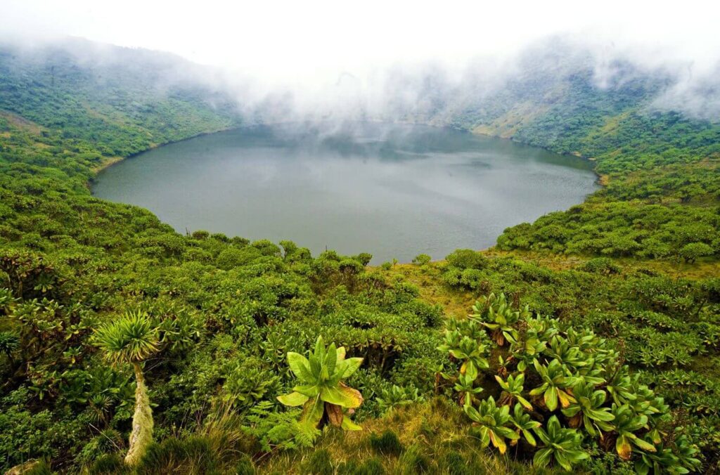
Mount Bisoke is arguably the most popular day-hike in Rwanda, famous for the spectacular, emerald-green crater lake that sits perfectly at its summit. Visually striking, Bisoke is a classic cone-shaped volcano.
The hike begins at the Kinigi park headquarters and takes you past rural farmlands before crossing the park boundary wall.
The trail rises steeply through bamboo forests, where hikers must navigate thick mud, exposed tree roots, and steep inclines.
Along the route, your park guides will point out unique flora and flora, and if you are incredibly lucky, you might even cross paths with a wild gorilla group or golden monkeys moving through the undergrowth.
Reaching the summit rewards you with the breathtaking sight of the 400-meter-wide crater lake.
Peering across the water, you are looking directly at the international border separating Rwanda and the DRC.
-
Mount Muhabura: The Sharp Ascent
- Elevation: 4,127 meters (13,540 feet)
- Duration: 1 Day (approx. 6 to 9 hours round-trip)
- Difficulty: Strenuous
Mount Muhabura, meaning “The Guide” in the local dialect, historically served as a natural navigation landmark for travelers across the region.
It is the second-highest peak in Rwanda’s sector of the Virungas and features an exceptionally steep, relentless incline.
Unlike Karisimbi, which breaks the climb over two days, Muhabura must be conquered in a single day. This means hikers must ascend and descend over 1,200 vertical meters in a short window.
The trail leads up open ridges, offering vast, unobstructed views of Rwanda’s twin lakes, Lake Burera and Lake Ruhondo, glittering far below.
At the summit sits a cold, beautiful crater lake where brave hikers can take a brisk dip.
Because of its open terrain, Muhabura offers some of the clearest and most expansive scenic views in the entire park.
-
Mount Gahinga: The Gentle Giant
- Elevation: 3,474 meters (11,397 feet)
- Duration: 1 Day (approx. 4 to 6 hours round-trip)
- Difficulty: Moderate / Easy-Moderate
For those who want to experience the magic of the Virunga without the intense physical toll of Karisimbi or Muhabura, Mount Gahinga is the ideal choice.
Its name means “a small pile of stones,” referencing the volcanic rock piles cleared by local farmers from the foothills.
The hike is relatively gentle, winding through beautiful bamboo groves and pristine afro-montane forest.
It is a haven for birdwatchers, with numerous endemic Albertine Rift bird species calling this ecosystem home.
Instead of an open body of water, the shallow crater at Gahinga’s summit has evolved into a unique, lush swamp and moorland ecosystem.
-
Mount Sabyinyo: The Boundary Marker
- Elevation: 3,669 meters (12,037 feet)
- Difficulty: Extreme (Accessible primarily from the Ugandan side)
Mount Sabyinyo, meaning “Old Man’s Teeth” due to its jagged, serrated summit ridges, marks the exact tri-point where the borders of Rwanda, Uganda, and the DRC converge.
While the actual geographic peak can be seen from Rwanda, the safe, established hiking routes utilizing wooden ladders and ridges are managed via Mgahinga Gorilla National Park on the Ugandan side.
Practical Planning and Logistics
- Getting There: The park headquarters at Kinigi are located near Musanze (Ruhengeri). It is an easy 2-hour drive on paved roads from Kigali International Airport.
- What to Pack: Sturdy waterproof hiking boots, thick gardening gloves (to protect against nettles), a waterproof rain jacket, gaiters, and layers for cold weather at high altitudes.
- Fitness Preparation: Bisoke requires good general fitness, while Karisimbi demands serious endurance. Acclimatizing to the altitude helps prevent fatigue.